Boscalia Technologies LLC can participate in the ESA Center of incubation for the Community of Madrid thanks to the SATree project.
![]()
OBJECTIVE
Our objective is to create a predicative model based on multivariate analysis and satellite remote sensing to determine the species of trees, their density, and their distribution in wooded areas using VIS-NIR hyperspectral imaging from ESA’s Sentinel-2 satellite.
This project will allow forest overseers to make accurate management decisions quickly without needing precedents on the sustainable management of forests, biodiversity conservation, or the development of research programs.
This innovative predicative model will be developed based on data from the same type of VIS-NIR spectrum references obtained from the surface of the earth using a new VIS-NIR spectrophotometer designed and developed for Boscalia Technologies LLC.
PROBLEMS TO RESOLVE
Managing and conserving forests is a complicated task that requires a profound knowledge of the local or regional forest species and their distribution. The heterogeneity of the species, the expensive resources needed to carry out the work, and difficulties with inspecting remote or inaccessible areas, are the main challenges in developing an appropriate forest management plan. As such, we have developed SATree as a solution.
Some of the most common forest management activities are: the exploitation of wood or biomass, biodiversity conservation, effects on climate change, human influence on the ecosystems, illegal tree-felling, deforestation, fires and other natural threats, control of invasive and threatening species, or the development and implementation of forest management plans.
SOLUTION
Near-infrared spectrometry (NIR) can distinguish between botanical species using the spectrums of wood and leaves.
Our company is developing predicative models based on an algorithm created by comparing a series of VIS-NIR spectrums obtained on site (from a representative sample of the tree population) and spectrums of hyperspectral satellite images gathered by the Sentinel-2 satellites.
This algorithm will then be implemented in a geographic information system (GIS) software program. As a result, each pixel of the image gathered by satellite remote sensing and containing the values of intensity corresponding to each spectral band will be assigned to a particular species or a combination of them. This set of interpreted pixels will make up a map of tree species that will be exported as a new layer for the user.
TECHNOLOGY DEVELOPMENT
The predicative model will be based on four technological pillars: VIS-NIR spectrophotometers, satellite images, chemometrics of VIS-NIR spectrums, and GIS:
– VIS-NIR spectrophotometers: our company will develop a portable reflective spectrophotometer with a detector that covers all longitudinal bands of integrated wavelengths in Sentinel-2’s hyperspectral camera. The internal components will have one section using a Czerny-Turner system with a longitudinal wavelength range of 360-1.100 nm and two F-TIR sections with ranges of 1.350- 1.650 and 1.750-2.150 nm.
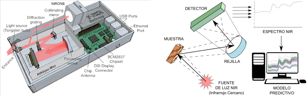
Basic diagram of a spectrophotometer and the VIS-NIR information analysis process
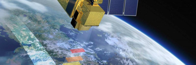
– Satellite images: Sentinel-2 has a generator of multispectral images (MSI). This set of spectrum values obtained through satellite remote sensing should be unique and distinguishable for each species of tree.
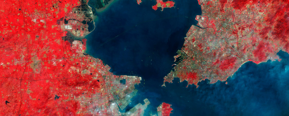
Image from the Sentinel-2 Satellite(1)
– Multivariate analysis: a set of statistical processes that simultaneously analyzes various characteristics or variables of an element (pixel) and produces a unique result, which is the value you are looking for. This analysis is achieved using an algorithm obtained from reference data that will classify the values of each pixel and assign them to a species of tree or a set of species.
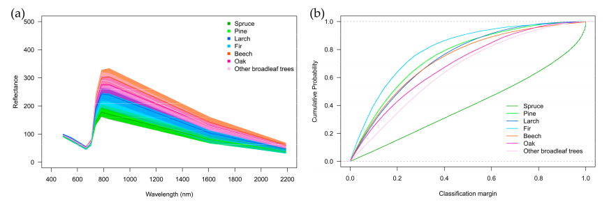
Gráficas de imagen espectral según especies forestales (2)
– Geographic information systems: GIS will combine and interpolate different layers of georeferenced information to generate a map of the forest. This map will be used as a tool for forest overseers to visualize the distribution of different species and their changes over time, as well as to collect quantitative data (of the surface, distance, degree of change).
GIS analysis of forest species (3)
(1) http://geocento.com/satellite-imagery-gallery/sentinel-2/
(2)First Experience with Sentinel-2 Data for Crop and Tree Species Classifications in Central Europe; Markus Immitzer , Francesco Vuolo and Clement Atzberger
(3)IDENTIFICATION AND MAPPING OF TREE SPECIES IN URBAN AREAS USING WORLDVIEW-2 IMAGERY; Y. T. Mustafa a , H. N. Habeeb b , A. Stein c , F. Y. Sulaiman b